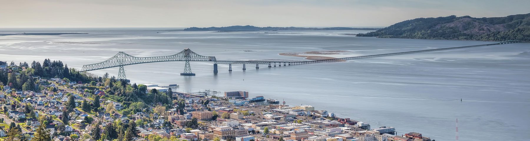
Youngs Bay
 The Youngs Bay Watershed is located near the mouth of the Columbia River in the northwest corner of Clatsop County and the State of Oregon. The Lewis and Clark River, Youngs River and the Walluski (also spelled Wallooskee) River are the dominant stream systems of the Basin. The Youngs River, from its headwaters to the entrance of the Bay, is approximately 17 miles long. The Lewis and Clark River, flowing through state forestry, private forestry, residential communities and farmland empties into Youngs Bay and then the Columbia River after 21 miles.
Elevations within the watershed range from sea level at Youngs Bay to 3,284 feet (Saddle Mountain) in the southern part of the watershed. The watershed land base is about 160 square miles (~120,000 acres) and represents 24 % of Clatsop County. Over 250 miles of streams and rivers make up the waterways of the Youngs Bay Watershed.
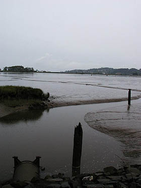
The lower reaches of the Lewis and Clark River and Youngs River are components of the Columbia River Estuary. The Columbia River Estuary is a nationally-significant estuary, rich in natural resources, supporting some of the largest anadromous fish runs in the world and providing unique habitat for sensitive and endangered species. Past research shows that the Youngs Bay Estuary is one of the Lower Columbia’s most biodiverse areas. The Youngs Bay Watershed also provides several communities with municipal water.
The dominant land use in the Youngs Bay Watershed is commercial forestry, with 90% of the watershed owned by Campbell Global. Campbell Global is an engaged and active partner of the NCWA, cooperating on numerous watershed restoration projects county-wide. Lewis and Clark National Historic Park’s Fort Clatsop is also located in the watershed and receives more than a quarter of a million visitors a year. The NCWA has partnered with the park on floodplain restoration projects at Colewort Creek and Otter Point. The city of Warrenton’s water supply is also located in the Youngs Bay watershed, near the headwaters of the Lewis and Clark River.
 Today
Today
Today, local residents and Watershed Council members are focused on the declines in salmon and trout, water quality, water quantity and environmental monitoring.
Limited population information is known about salmon and trout in the Youngs Bay Watershed. Historically, fall chinook, coho, steelhead, sea run cuthroat and chum found their way into the rivers to spawn. Today, most populations are in decline, with chum no longer in the Basin. Besides salmon and trout, the Watershed is home to a variety of estuarine and freshwater species, examples include pacific lamprey, stonerollers, peamouth, sculpin, and stickleback.
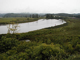
In 2000, a fish counter was positioned by the Oregon Department of Fish and Wildlife on the Lewis and Clark River to identify adult fish passing through the fish ladder at the City of Warrenton’s primary reservoir.
In 2013, the Youngs Bay Watershed Council partnered with Astoria High School and Clatsop Community College to reboot a water quality program established in 2000. In 2014, five new locations were chosen for temperature testing, based on chum habitat and freshwater mussel habitat.
The City of Warrenton, located in the adjacent watershed, is one of the fastest growing communities in Oregon and has municipal water rights to the Youngs Bay Basin (specifically the Lewis and Clark River). Concerns surrounding this water right and the current and future draws from the River are of great concern to the council.
Watershed Assessment
The Youngs Bay Watershed Council completed an assessment of the watershed in 2000. The assessment gives an overview of the basin, provides historic context and recommends restoration actions. The council uses the document as a guide for its restoration actions in the watershed.
Read the Youngs Bay Watershed Assessment
If you are interested in Youngs Bay or Bear Creek Watershed Council meeting minutes, please contact Brooke Stanley at northcoastwatershedcouncils@gmail.com.
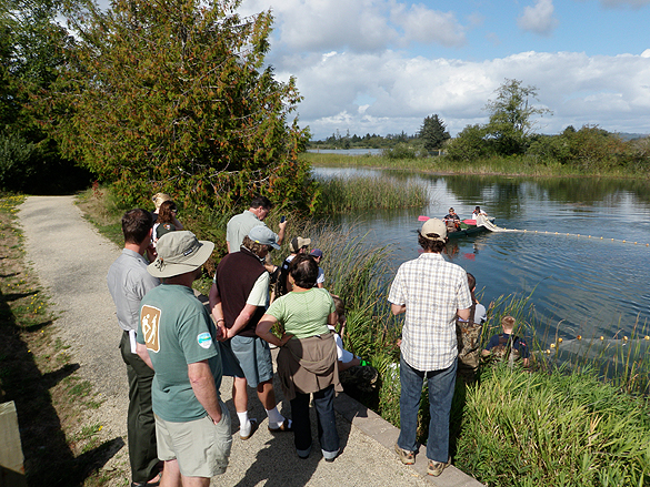
(Above) Astoria High School Fisheries Tech students give a fish seining demonstration for NCWA members on the Lewis and Clark River.